
Go to the new Maps web site page here – https://www.focc.asn.au/pages/projects/maps.html
Park Maps:
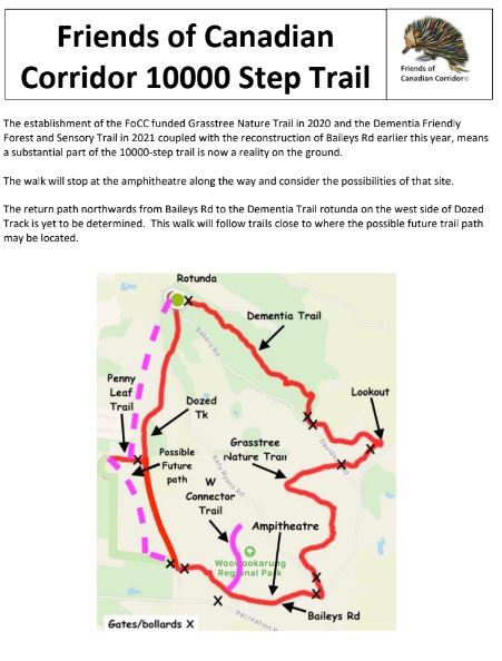
FoCC 10000 Step Trail Map (2024)
Friends of Canadian Corridor 10000 Step Trail Walk
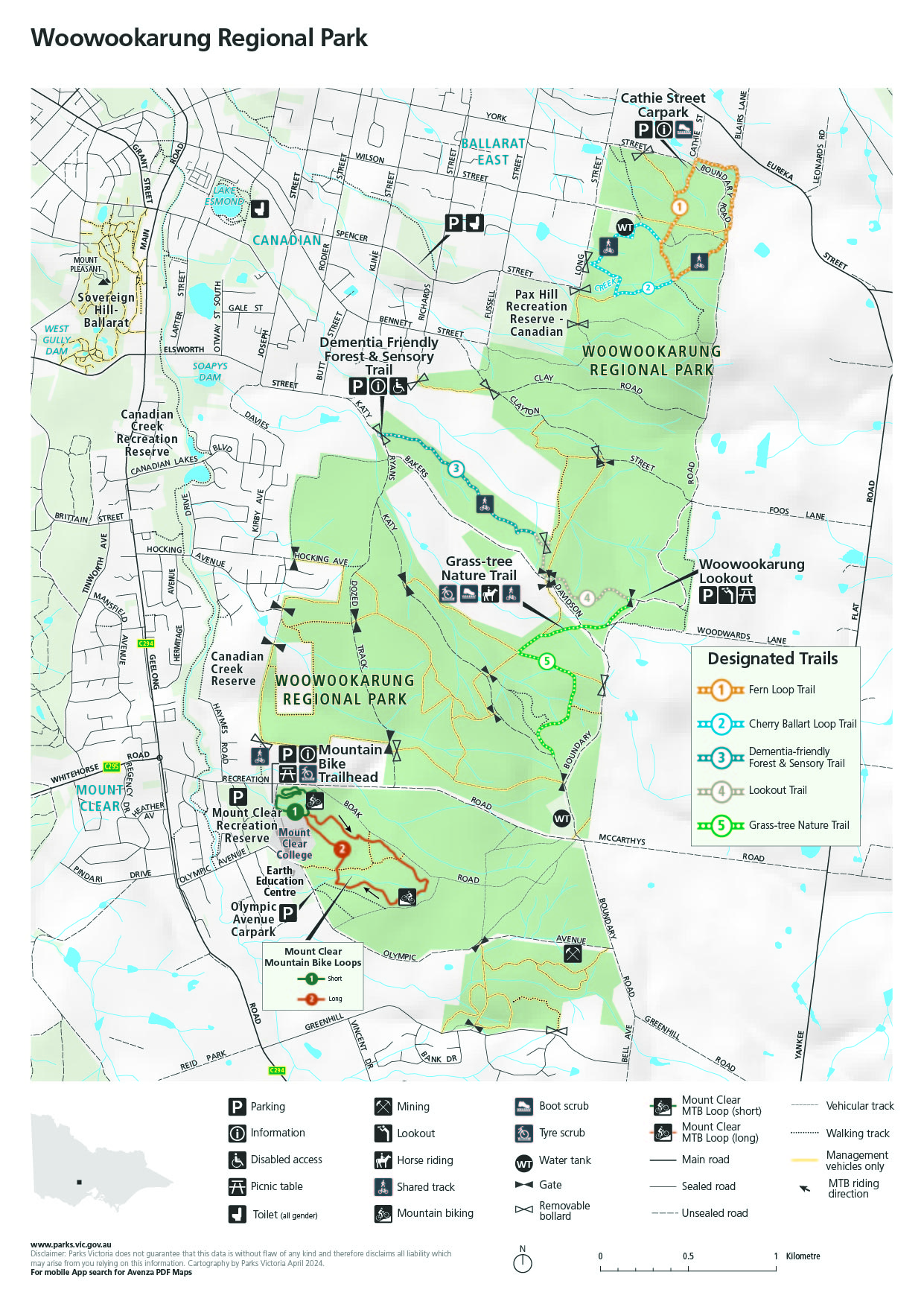
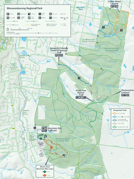
Parks Vic 2024 Woowookarung Trails Map
P1 and 4 2024 Page 2 and 3 2024 (2Pages – Trifold)
Bunny Trail Trifold Map, with Other Trails Map: Click here to download or view


WoowookarungRP with some walking / cycling trails
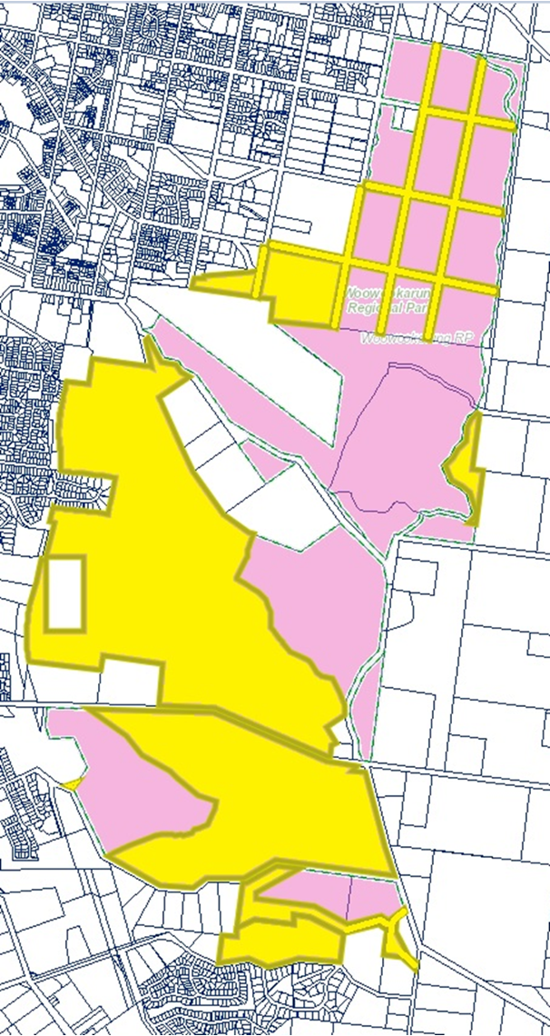 Rezoning of the Park on 17/2/2026 from FZ farming to PCRZ Public Conservation and Resource Zone; See the attached documentation here…C255ball Explanatory Report Approval Gazetted
Ballarat Map 1936 (Courtesy of the City of Ballarat Library Australiana Room)

Woowookarung Regional Park map.
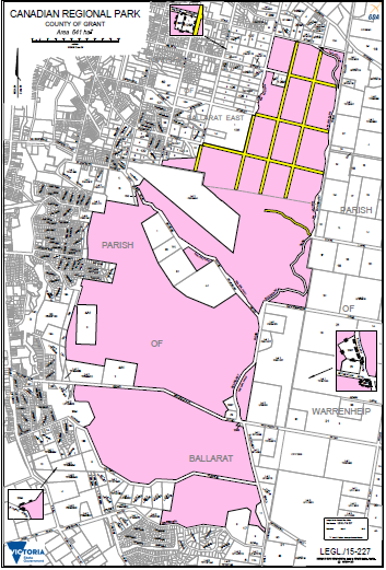
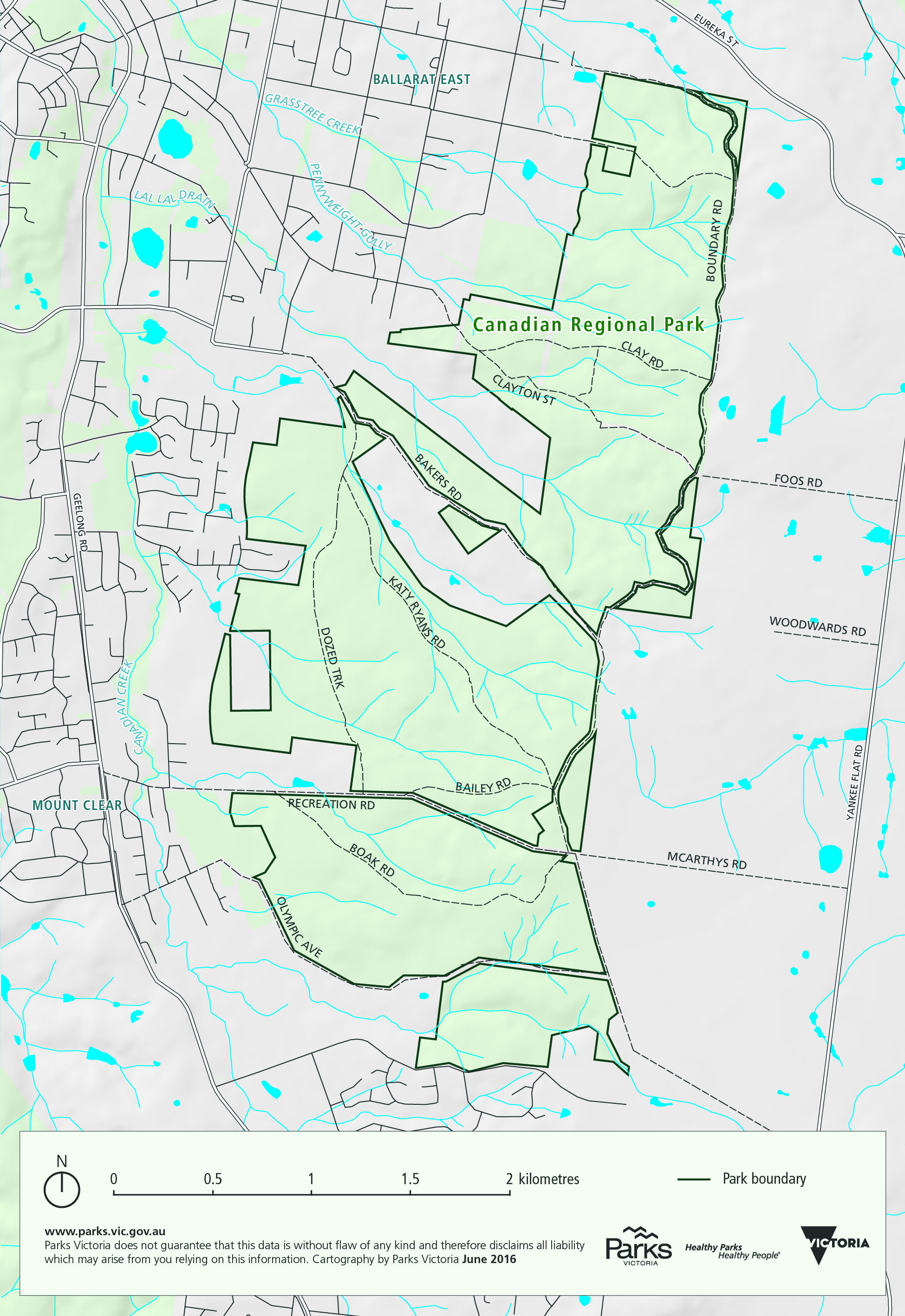
Canadian-Regional-Park-LEGL.15-227
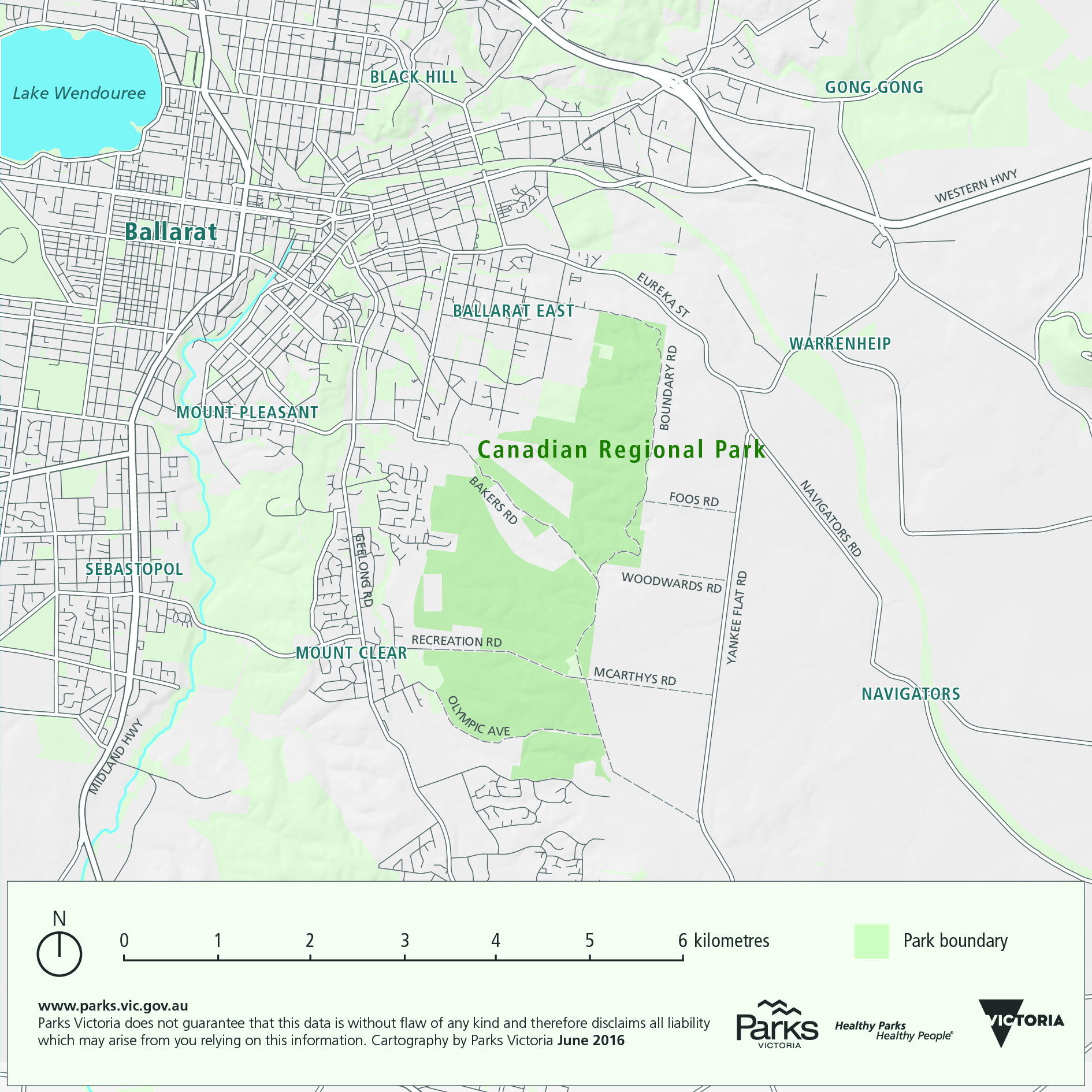
Woowookarung Regional Park locality map
Woowookarung Regional Park hydro imagery map

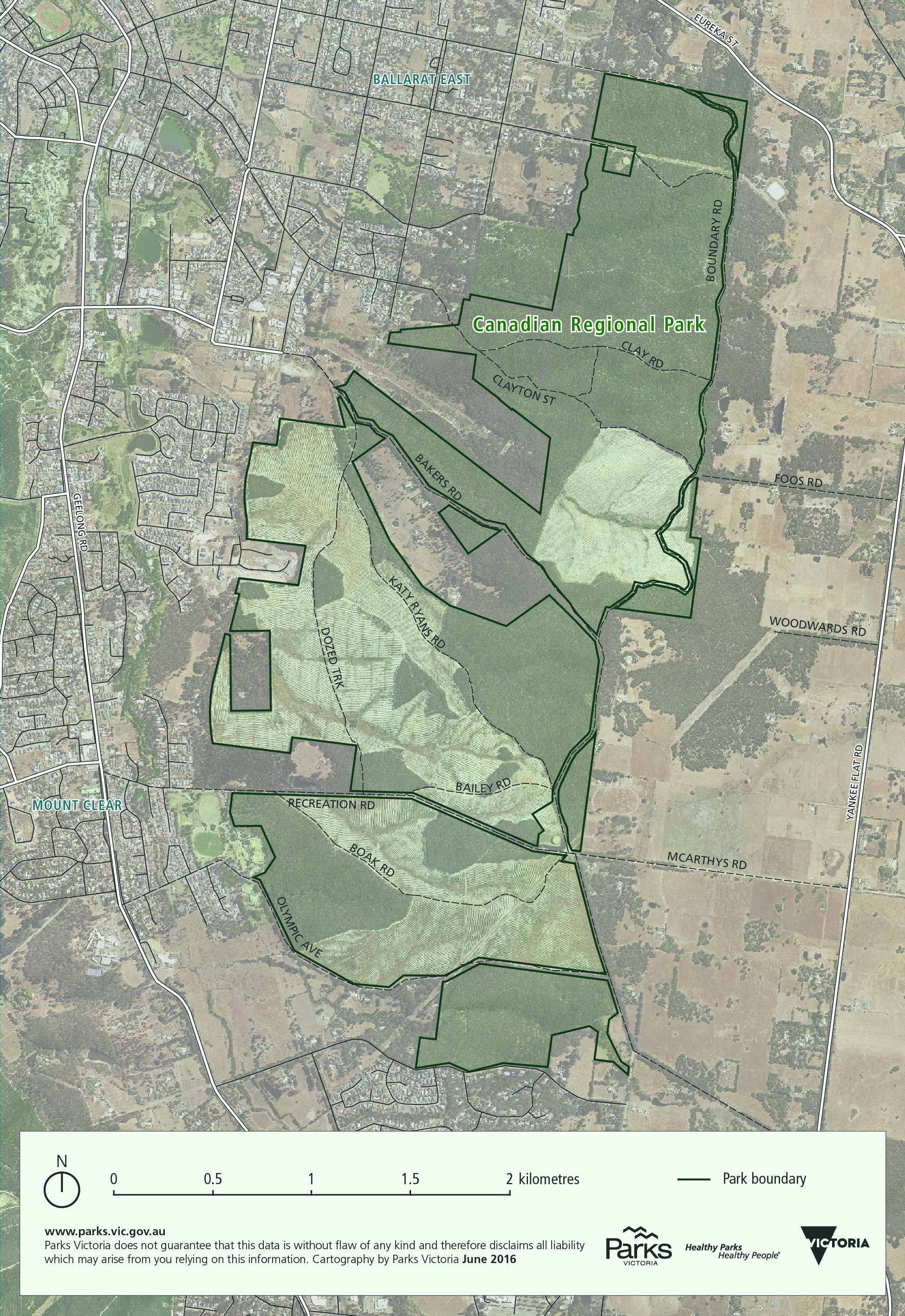
Woowookarung Regional Park hydro relief map
Woowookarung Regional Park operations relief map
`